
Rating 5 of 5 stars
Precisione
persone veramente professionali
December 19, 2017 | Andrea MilitanoBernasconi e Forrer ingegneria e misurazioni SA is a company founded in 2014 from the merger of the engineering firms Maderni Capezzoli Forrer Sagl (founded in 1921) and Gisi e Bernasconi SA (founded in 1971). In 2019, we also integrated the surveying division of the Antonio Bottani engineering firm. Our activities in the canton in the fields of surveying, land registry, and rural engineering can therefore boast several decades of experience!
The current co-owners are Cristiano Bernasconi, Antonio Bottani, and Fabio Forrer, all of whom are engineers who graduated from the Swiss Federal Institute of Technology in Zurich and are surveyors registered in the federal register of surveyors.
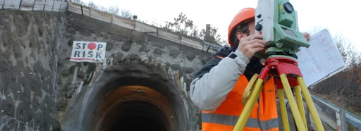
Today, the office employs around thirty people. They are specialized and experienced professionals who work with modern surveying and land data processing systems. Over many years of activity, the company has earned the trust of public bodies, cantonal offices, municipalities, consortia, construction companies, engineering firms, architectural firms, and private clients who appreciate our expertise, the quality of our work, and our speed in completing the tasks entrusted to us.
The firm recognizes the importance of good training and has therefore always been committed to training apprentices in the field of geomatics (in particular official surveying and technical surveying).
Our firm's services and activities revolve around the central themes of:
official surveying (cadastre)
technical surveying (related to construction and infrastructure works)
land management ( municipal engineering)
More specifically:
Keeping official measurements up to date in the municipalities of:
Bioggio
Cademario
Collina d'Oro
Comano
Corippo
Cureglia
Grancia
Lugano
Massagno
Monteggio
Melide
Origlio
Paradiso
Capriasca Bridge
Savosa
Sorengo
Torricella-Taverne
Vezia
Real estate appraisals and evidence for future reference ( assessment of the commercial value of properties, photographic documentation of the condition of buildings and infrastructure near construction sites)
Formwork (formwork up to 27 m high, equipment rental, marking of significant points, assembly and dismantling of formwork)
Topographic survey (land profiles and sections, processing of plans with contour lines, 3D digital terrain models)
Architectural survey (survey of exterior and interior details of buildings, rendering of plans, facades, and sections, development of three-dimensional BIM models)
Marking out reference axes and elevationson constructionsites, verification of compliance with building regulations for municipal authorities (compliance with building permits)
Excavation volumes and material deposits (surveys using laser scanners, terrestrial and satellite measurements, photogrammetry, volume calculation by comparing before and after terrain models)
Geodetic monitoring (determination of settlements and displacements in the order of mm, manual measurements and/or installation of automatic infrastructure with data transmission via the web)
Property by floor ( preparation of the quota distribution plan, preparation of the common area allocation plan, calculation of thousandths)
Municipal engineering (computerization of zoning plans, land improvements, pipeline cadastre)
Opening times
Rating 4.5 of 5 stars
Opening times
Reviews for Bernasconi e Forrer ingegneria e misurazioni SA
Rating 5 of 5 stars
persone veramente professionali
December 19, 2017 | Andrea Militano


